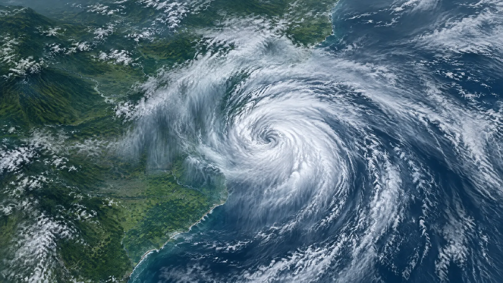
Deep Depression has crossed the coast: the latest IMD status
India weather today is being shaped by the IMD-classified Deep Depression that crossed the north Andhra Pradesh coast close to southwest of Kalingapatnam between 11 pm IST on 23 September and 1 am IST on 24 September. In its 9:25 am all-India bulletin, the India Meteorological Department said the centre was over north coastal Andhra Pradesh at 5:30 am, about 50 km west of Kalingapatnam, 80 km north-northeast of Visakhapatnam and 170 km southwest of Gopalpur. The immediate concern is now intense rain and squally conditions along and inland of its track, rather than an offshore approach.[1]
This article uses the official term Deep Depression. It should not be described as a cyclonic storm: IMD’s current analysis says it crossed as a Deep Depression, with maximum sustained winds of 55–65 kmph gusting to 75 kmph. The agency expects it to move northwestwards while initially maintaining that intensity for about 12 hours, then turn north-northwestwards and weaken gradually during the following 24 hours.[1] [2]
For readers searching for India weather today 24 September 2026 deep depression rain alerts, the practical message is to follow the newest district administration and IMD notices rather than treat a statewide forecast as a street-by-street prediction. IMD’s day-one warnings are valid from 8:30 am on 24 September until 8:30 am on 25 September, and conditions can change as the circulation moves inland.[1]
Rain and wind alerts by state on 24 September
Forecast: IMD says heavy to very heavy rain with isolated extremely heavy falls is very likely at isolated places over Coastal Andhra Pradesh and Yanam, Odisha, Telangana and Chhattisgarh on 24 September. It separately forecasts heavy to very heavy rain at isolated places over Bihar, Jharkhand, Vidarbha, and West Bengal and Sikkim, while East Madhya Pradesh, East Uttar Pradesh, Karnataka, Kerala and Mahe, Marathwada, Assam and Meghalaya are in the heavy-rain outlook. These are forecast hazards, not reports that every listed place will receive the same rain total.[1]
Wind warning: IMD’s morning bulletin forecasts thundersqualls with winds of 50–60 kmph, gusting to 70 kmph, at isolated places in Chhattisgarh, Coastal Andhra Pradesh and Yanam, Odisha and Telangana on 24 September. Along and off the south Odisha–north Andhra Pradesh and Yanam coast, the cyclone bulletin said squally winds of 55–65 kmph, gusting to 65 kmph, were expected through the morning, easing to 45–55 kmph, gusting to 65 kmph, by the evening. The exact local timing is important for travel, outdoor work and small craft.[1] [2]
Sea warning: Very rough to rough seas were forecast along and off the north Andhra Pradesh, Odisha and West Bengal coasts until the evening of 24 September, with gradual improvement thereafter. IMD advises fishermen not to venture into the westcentral, adjoining northwest and southwest Bay of Bengal, or along and off the Andhra Pradesh, Odisha and West Bengal coasts, until 25 September. This is a safety instruction, not merely a general forecast.[2]
Actionable guidance for Andhra Pradesh, Odisha, Telangana and Chhattisgarh
In north coastal Andhra Pradesh, residents and travellers should check district-level notices before setting out, allow extra time, and avoid flooded roads or drains. IMD’s flash-flood guidance identified a low to moderate risk of surface runoff or inundation in low-lying, saturated areas of Anakapalli, Kakinada, Visakhapatnam, Vizianagaram, Srikakulam, Parvathipuram Manyam and Sri Alluri Sitharamaraju districts, among others, through 5:30 pm IST on 24 September. That is guidance about a possible short-term hazard, not confirmation that flooding has occurred in each district.[2]
In Odisha, the national warning calls for heavy to very heavy rain with isolated extremely heavy rain, plus isolated thundersqualls. IMD’s overnight flash-flood guidance named watersheds and neighbourhoods in districts including Ganjam, Gajapati, Koraput, Malkangiri, Rayagada, Kalahandi, Puri, Khurda, Cuttack, Angul and Kandhamal as having low to moderate flash-flood risk through 5:30 pm. People in low-lying or hilly locations should monitor local official instructions, keep away from fast-moving water, and avoid taking shelter beneath trees during lightning.[1] [2]
In Telangana and Chhattisgarh, IMD forecasts heavy to very heavy rain with isolated extremely heavy falls on 24 September; Telangana remains in the extremely-heavy-rain outlook on 25 September as well. The bulletin also flags thundersquall potential. For the 24-hour flash-flood guidance window, it names Mulugu in Telangana and Gariaband and Kondagaon in Chhattisgarh. The sensible response is to secure loose outdoor objects, charge essential devices, review a safe route if waterlogging develops, and follow state or district emergency directions rather than circulate unverified warning graphics.[1] [2]
What is confirmed, what is forecast and what to watch next
Confirmed observation: the coast crossing and the 5:30 am position over north coastal Andhra Pradesh are IMD observations. IMD’s 23 September press release also recorded extremely heavy rain in south Odisha during the preceding 24-hour observation period ending at 8:30 am that day. Those observations show that heavy rain had already occurred, but they do not establish a fresh 24 September rainfall total for every state now under warning.[1] [3]
Forecast and warning: the system is expected to weaken only after its initial inland phase. IMD’s earlier national bulletin projected a Depression by the evening of 24 September and a well-marked low-pressure area by 26 September; the RSMC tropical outlook also set out that weakening track. Forecasts express the most likely evolution, not a guarantee, so readers should use the next IMD update for any change in location, wind or warning area.[2] [4]
Independent reporting before the crossing described the same IMD track toward the Andhra Pradesh–Odisha coast and the expected inland rain risk.[5] The latest official bulletin now supersedes that pre-crossing outlook on the central fact: the Deep Depression is inland. No confirmed casualties, damage totals or transport disruption figures are reported in this article because the IMD weather bulletins provide hazard and preparedness guidance, not a verified impact tally.
A practical checklist while warnings remain active
Check the time and issuing authority on every alert. Use IMD for system status and weather warnings, then your state disaster-management authority, district collectorate, police or local municipal body for closures, evacuations, road conditions and assistance. If a route is affected by heavy rain, do not drive or walk into water whose depth or current cannot be judged. Keep children and pets clear of drains, culverts, riverbanks and the seafront until local authorities say conditions are safe.[1] [2]
For households, keep phones charged, store drinking water and necessary medicines, and bring in or secure objects that can be blown about. IMD warns that strong wind and rain can affect small trees, vulnerable structures, plantations, roads and visibility. Its suggested actions include staying in a safe place during worsening conditions, avoiding shelter under trees, moving away from water bodies and unplugging electrical or electronic appliances if lightning is expected.[2]
The risk will not end uniformly when the coast improves. The forecast shifts the heaviest concern inland across parts of Andhra Pradesh, Odisha, Telangana and Chhattisgarh, then toward central and eastern India as the circulation weakens. Treat the forecast as a time-bound safety tool: recheck official updates before travel, fishing, field work or outdoor events, and distinguish an IMD warning from a confirmed local impact report.[1] [2]
Questions readers ask
Is the Bay of Bengal system a cyclone?
No. IMD classifies it as a Deep Depression. It crossed the north Andhra Pradesh coast early on 24 September as a Deep Depression and is forecast to weaken gradually after its initial inland phase.[1] [2]
Which states have the highest rain warning on 24 September?
IMD forecasts heavy to very heavy rain with isolated extremely heavy falls over Coastal Andhra Pradesh and Yanam, Odisha, Telangana and Chhattisgarh. It also has heavy-rain or heavy-to-very-heavy-rain outlooks for several nearby states and regions.[1]
Are fishermen advised to go out to sea?
No. IMD advises fishermen not to venture into the specified westcentral, northwest and southwest Bay of Bengal areas or along and off Andhra Pradesh, Odisha and West Bengal coasts until 25 September.[2]
What should residents do during a thundersquall or intense rain?
Follow local official instructions, stay away from flooded roads and water bodies, avoid sheltering under trees, secure loose objects and keep updated through IMD and district authorities. Do not treat a forecast as confirmation that an impact has happened in a specific locality.[1] [2]
Sources
- All India Weather Summary and Forecast Bulletin, Morning, 24 September 2026 — India Meteorological Department. Accessed 2026-09-24.
- National Bulletin No. 12 (BOB/06/2026), 24 September 2026 — India Meteorological Department. Accessed 2026-09-24.
- Press Release: Deep Depression over Westcentral and Adjoining Northwest Bay of Bengal, 23 September 2026 — India Meteorological Department. Accessed 2026-09-24.
- Special Tropical Weather Outlook for the North Indian Ocean, 23 September 2026 — RSMC Tropical Cyclones New Delhi / India Meteorological Department. Accessed 2026-09-24.
- Deep depression in Bay of Bengal could bring extremely heavy rainfall in India, Nepal — Down To Earth. Accessed 2026-09-24.
Anna News Desk reviewed five sources on 24 September 2026, including four IMD/RSMC bulletins and independent reporting by Down To Earth. Forecasts and warnings are attributed to IMD and separated from observed weather and confirmed impacts. Conditions can change; readers should follow the latest official local guidance.