Hurricane Polo Baja California: the direct answer
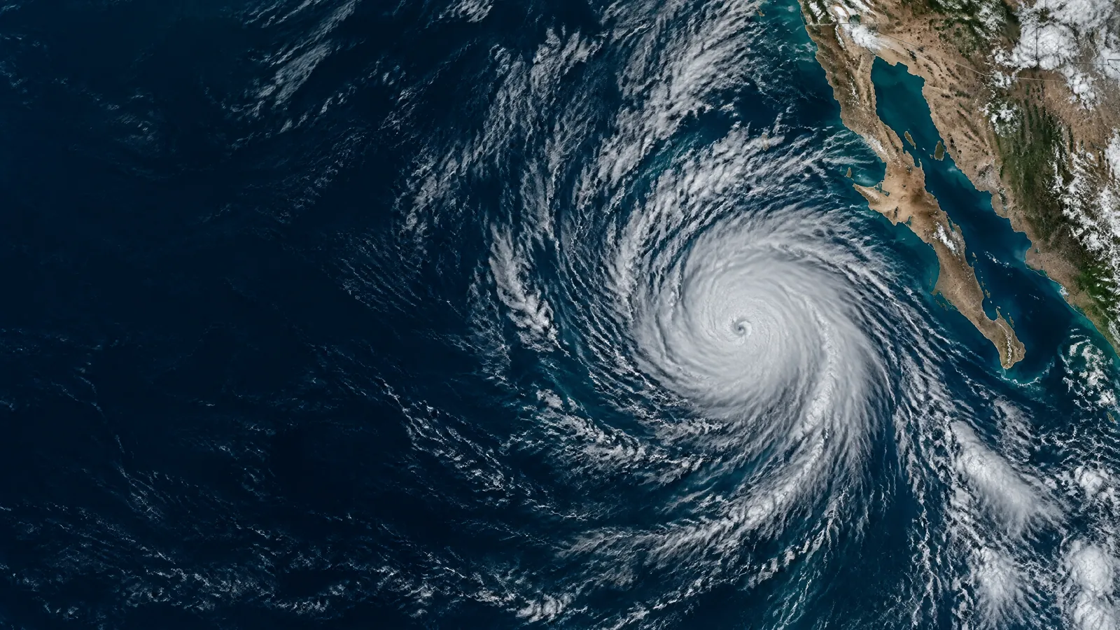
**For readers tracking Hurricane Polo Baja California impacts, the storm is still active and its advisories have not ended.** In the newest NHC product available when this guide was checked — Intermediate Advisory 23A at 5:00 AM MST on Saturday, 26 September — Polo remained a Category 5 hurricane. Its centre was near 17.7°N, 111.5°W, about 380 miles (610 km) south-southwest of Cabo San Lucas, moving west-north-west near 10 mph (17 km/h). Maximum sustained winds were near 160 mph (260 km/h).[2]
That is a small reduction from the 165 mph in the preceding 2:00 AM full advisory, not evidence that the danger has passed or that Polo has generally weakened. The latest product still described a Category 5 hurricane and retained a Hurricane Watch from Punta Eugenia to Santa Fe in Baja California Sur.[1] [2] There was no confirmed landfall in the available official record, no notice that Polo had moved away from Baja California Sur, and no announcement ending NHC advisories.
The live question is therefore not whether an old hurricane headline still applies. It does. The useful distinction is that Polo was offshore and forecast to approach Baja California Sur, while the exact timing and effects at any one place remained subject to official updates. Check the timestamp on every alert you see; this page is a dated guide, not a substitute for the next NHC, Servicio Meteorológico Nacional (SMN) or Protección Civil bulletin.[2] [3]
Current NHC Polo advisory: track, watch and what is not confirmed
NHC’s 5:00 AM MST intermediate advisory said Polo should turn gradually north-west later on Saturday, north on Sunday and north-east by Monday, approaching Baja California Sur. It said slow weakening was forecast to begin overnight, but Polo was still expected to remain a powerful hurricane as it approached.[2] That is an official forecast of an approach, not a confirmed landfall point, a guarantee that the centre will cross the coast, or a forecast for a particular resort, airport or road.
The current coastal designation matters. A **Hurricane Watch** was in effect for Punta Eugenia to Santa Fe; NHC said hurricane conditions were possible there by Monday afternoon. Tropical-storm conditions were possible first in the southern part of that watch area from Sunday night into early Monday, then could spread north during Monday.[2] A watch calls for preparations and close attention. It is not a Hurricane Warning, and the latest advisory did not list a hurricane warning for Baja California Sur.[2]
In official NHC terminology, a hurricane watch means hurricane-force sustained winds are possible in a specified area. It is generally issued about 48 hours before tropical-storm-force winds could begin. A hurricane warning means such winds are expected, generally within 36 hours.[5] Those words are practical cues, not interchangeable labels: finish time-consuming preparation during a watch; follow any later warning or evacuation instruction without waiting for a favourite app to agree.
Why the Hurricane Polo track cone is not a landfall promise
The NHC cone shows the probable path of **Polo’s centre**, not a narrow corridor where all danger stays. It is built from historical official track errors: the 2026 eastern Pacific circles are sized so that two-thirds of comparable historical forecast errors fell inside them.[4] Put simply, the centre can be outside the drawn line, and impacts can extend well beyond the cone. Rain bands, onshore waves, flooding and gusty winds do not stop at its edge.
For Polo, NHC’s full 2:00 AM discussion found little cross-track spread among its guidance but still noted substantial along-track, or timing, differences. It advised residents in Baja California Sur and north-western mainland Mexico to consider completing preparations by Sunday.[3] That is more useful than trying to choose a single computer-model landfall dot: prepare for the period of risk, use local official alerts for your municipality, and keep a plan that still works if weather arrives earlier or later.
Do not infer safety because a home, hotel or beach sits on one side of a centre line. Nor should a forecast track be used to announce that a named community will be struck. NHC defines landfall as the intersection of a tropical cyclone’s surface centre with a coastline; damaging winds and water can affect land without that exact event, while a centre can cross land with the strongest winds elsewhere.[5] The appropriate wording on 26 September is that Polo is forecast to approach, not that a model has settled its landfall.
Rain, flooding, surf and rip-current risks supported today
The rain risk is currently supported by the NHC advisory. It forecast 4 to 8 inches (about 100 to 200 mm) across parts of Baja California Sur, with isolated maxima of 10 inches (250 mm). NHC warned that this could cause life-threatening flooding and mudslides, especially in steep terrain.[1] [2] Mexican SMN guidance had also warned that Polo-related rain can raise rivers and arroyos, trigger landslides and flood low-lying areas.[6]
Treat arroyos, low crossings and flooded streets as routes to avoid, not as shortcuts. The Baja California Sur State Civil Protection Council’s 25 September report asked people to avoid arroyo channels, flood-prone areas and other risk sites, while securing loose outdoor objects before winds increase.[8] Never drive around a barrier or into water whose depth, current or road surface you cannot see. If an official tells you to leave an exposed area or use a designated shelter, act on that local instruction rather than testing the route yourself.
The coastal risk is already relevant before a closest approach. NHC said swells from Polo would spread along the Baja California Peninsula through the weekend and could produce life-threatening surf, rip currents and coastal flooding. It also said surge could cause significant coastal flooding where winds are onshore, accompanied near the coast by large destructive waves.[1] [2] Keep out of the sea, away from jetties and rocks, and off beaches when officials, lifeguards or local closures say conditions are dangerous. A calm-looking interval does not make surf or a rip current safe.
Official safety route for residents, visitors and travellers
Use a simple official-information order. First, follow the latest NHC Polo advisory for the broad track, watch and hazard picture. Then use SMN/Conagua and your state or municipal Protección Civil channels for the alert level, local weather, school or port measures, shelters, evacuation orders and road restrictions that apply where you actually are.[2] [6] [7] Do not circulate a shelter address or evacuation route unless the responsible local authority has published it for the current event.
Prepare now rather than during tropical-storm-force winds. Mexico’s disaster-prevention agency CENAPRED recommends knowing the temporary shelters shown by local authorities and keeping an emergency bag with important documents, contacts, water, non-perishable food, a first-aid kit, a radio, a torch and batteries. It also advises maintaining roofs, windows and drainage before a storm.[10] Keep medicines, chargers and a way to receive alerts ready; arrange how family members will communicate if mobile networks are unreliable.
If you are told to evacuate, leave by the official route and time specified; do not improvise a coastal or arroyo shortcut. Take documents, medicines, essentials and any pets you can safely take, tell a trusted contact where you are going, and use the shelter or safer location named by authorities. If no evacuation is ordered, stay indoors during dangerous conditions and away from windows. Do not go outside during a temporary lull merely to inspect damage or take photographs.
For an immediate emergency in Mexico, call **911**. At sea, SEMAR lists **800 MARINA1 (800 627 4621)** for maritime emergencies.[9] Visitors should also keep their accommodation or tour operator informed, but a private operator cannot overrule Protección Civil. The U.S. Embassy’s Polo alert similarly advises people to monitor local authorities, be ready to seek shelter, check roads before travelling and check directly with airlines for flight changes.[11]
Baja California Sur operations and travel: what to check
The State Civil Protection Council in Baja California Sur announced a preventive suspension of classes on Monday, 28 September for all levels and shifts in the state’s five municipalities. Its report said machinery, equipment and staff were being deployed towards Comondú and Mulegé, and that the council would continue updating the public as conditions changed.[8] That is a real operational measure, but it is not a blanket list of road closures, hotel closures or shelter locations. Recheck it before making a journey or deciding whether school or work is operating.
For travel, build in the possibility of disruption rather than assuming a booked itinerary will run. Check the airline or ferry operator directly, confirm with your hotel, and look for the current municipal or state notice before driving. The U.S. Embassy warns that flights and roads can be affected by flooding and mudslides.[11] Canada updated its Mexico advice on 26 September to recommend avoiding non-essential travel in the Hurricane Watch stretch from Punta Eugenia to Santa Fe; that is travel advice, not a replacement for Mexican local orders.[12]
Independent reporting helps explain why readers are watching Polo closely, but not what to do in a locality. The Guardian’s 25 September analysis described Polo’s exceptional intensity and its anticipated movement towards the Baja California region.[13] Operational decisions should still rest on the NHC, SMN and Protección Civil updates because they are the sources that issue the current hazard and response information.
How to stay current without amplifying rumours
Before you share a Hurricane Polo post, check four things: the issuing authority, the issue time, the named area and whether it says watch, warning, forecast or observed impact. A screen capture from 24 or 25 September may describe conditions that have changed. A model graphic is not an official order. A dramatic category label alone does not tell a reader whether their municipality has an alert, a closure or an evacuation route.
The next official update may change Polo’s intensity, timing, watch area or hazards. If NHC upgrades, changes or cancels the watch, say exactly that rather than keeping this guide’s wording by habit. Until then, the correct status is clear: Polo remains an active hurricane offshore; the Baja California Sur Hurricane Watch remains in force in the latest available NHC advisory; and residents and visitors should complete sensible preparation, avoid coastal and flood hazards, and follow the local authority that serves their location.[2] [3]
Questions readers ask
Has Hurricane Polo weakened or dissipated?
No. In the newest NHC product available for this guide, Polo remained a Category 5 hurricane with maximum sustained winds near 160 mph (260 km/h). That was 5 mph below the preceding full advisory’s 165 mph, but NHC had not said the system had dissipated, moved away from the Baja California Sur threat area or ended advisories.[1] [2]
Is there a Hurricane Warning for Baja California Sur?
Not in the latest NHC advisory checked here. A Hurricane Watch was in effect from Punta Eugenia to Santa Fe. A watch means hurricane conditions are possible; a warning means they are expected. Keep checking NHC, SMN and Protección Civil because the status can change.[2] [5]
Will Hurricane Polo make landfall in Baja California?
No landfall had been confirmed at publication. NHC forecast Polo to approach Baja California Sur but noted timing uncertainty. Do not treat a model plot or the forecast centre line as a confirmed landfall point or a town-by-town impact forecast.[2] [3] [4]
Why can the coast be dangerous if Hurricane Polo stays offshore?
NHC says swells from Polo can cause life-threatening surf, rip currents and coastal flooding along the Baja California Peninsula, while rain bands can create flooding and mudslide hazards away from the centre. Stay out of the water and follow local beach, harbour and Civil Protection restrictions.[1] [2]
What should I pack if I may need to leave or shelter?
Use the local authority’s instructions first. CENAPRED’s general hurricane checklist includes documents, emergency contacts, water, non-perishable food, a first-aid kit, necessary tools, a radio and a torch with batteries. Add prescribed medicines and a charged way to receive alerts.[10]
Are schools closed in Baja California Sur because of Polo?
The State Civil Protection Council announced a preventive suspension of classes across Baja California Sur on Monday, 28 September, for all grades and shifts. Confirm the newest school, municipal or state notice before travelling, as weather measures can be amended.[8]
Which sources should travellers follow?
Use NHC for the cyclone advisory and track, SMN/Conagua and local Protección Civil for Mexican local conditions and instructions, then your carrier for transport changes. In an emergency in Mexico call 911; SEMAR gives 800 MARINA1 (800 627 4621) for emergencies at sea.[2] [6] [9]
Sources
- Hurricane Polo Public Advisory 23 — National Hurricane Center / NOAA. Accessed 2026-09-26.
- Hurricane Polo Intermediate Advisory 23A — National Hurricane Center / NOAA. Accessed 2026-09-26.
- Hurricane Polo Discussion 23 — National Hurricane Center / NOAA. Accessed 2026-09-26.
- Definition of the NHC Track Forecast Cone — National Hurricane Center / NOAA. Accessed 2026-09-26.
- Glossary of NHC Terms — National Hurricane Center / NOAA. Accessed 2026-09-26.
- Polo se intensificó nuevamente a huracán categoría 5 y se localiza a 430 km al sur-suroeste de Cabo Corrientes, Jalisco — Servicio Meteorológico Nacional / Gobierno de México. Accessed 2026-09-26.
- Aviso de Ciclón Tropical: Huracán Polo No. 39 — Servicio Meteorológico Nacional / Conagua. Accessed 2026-09-26.
- Polo avanza hacia Baja California Sur; acuerdan suspensión de labores escolares — Instituto Estatal de Radio y TV de Baja California Sur. Accessed 2026-09-26.
- Ante la presencia del huracán Polo, el Plan Marina en su fase de prevención en los estados del Pacífico — Secretaría de Marina / Gobierno de México. Accessed 2026-09-26.
- Ante huracanes prepararnos es nuestra responsabilidad — Centro Nacional de Prevención de Desastres / Gobierno de México. Accessed 2026-09-26.
- Weather Alert: Hurricane Polo — U.S. Embassy & Consulates in Mexico. Accessed 2026-09-26.
- Mexico travel advice — Government of Canada. Accessed 2026-09-26.
- Hurricane Polo barrels towards Baja California region of Mexico — The Guardian. Accessed 2026-09-26.
Anna News Desk prepared this current Hurricane Polo Baja California safety guide from the newest NHC advisory available at publication, Mexican national and Baja California Sur authority material, official traveller guidance and reputable independent reporting, all checked on 26 September 2026. The status is time-sensitive: the storm, watch area, hazards, local closures and official instructions can change with later advisories. This guide makes no model-led landfall claim and does not replace directions from SMN, Protección Civil, emergency managers or transport operators.